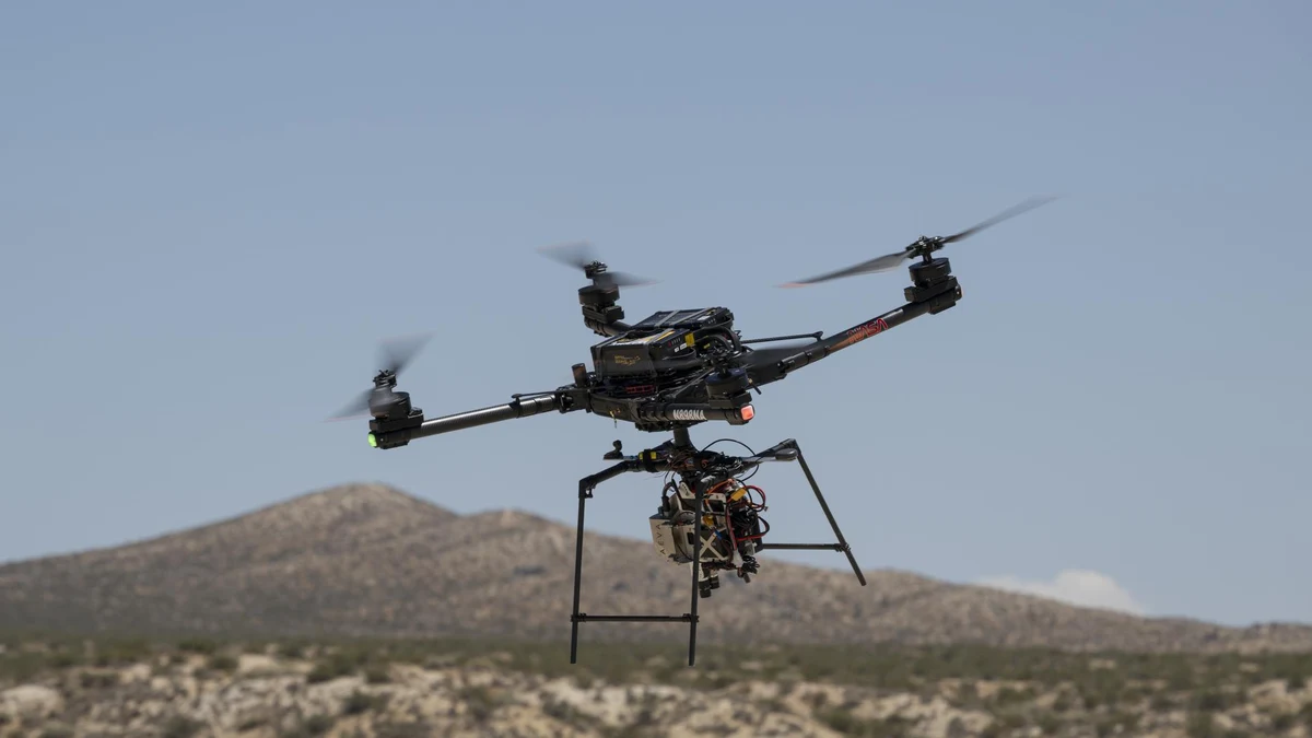
NASA's Armstrong Flight Research Center in Edwards, California detailed a series of autonomous navigation flight campaigns aboard an uncrewed Alta-X heavy-lift quadcopter carrying the agency's Safe and Precise Landing - Integrated Capabilities Evolution (SPLICE) guidance, navigation, and control payload. Conducted over desert lakebeds at Rogers Dry Lake across summer 2026, the tests bring autonomous terrain-relative hazard detection closer to operational readiness for future robotic lunar landers, crewed Artemis surface missions, and terrestrial precision vertical flight.
Real-Time Lidar Mapping and Hazard Diversion
Developed by engineers at NASA's Johnson Space Center in Houston and integrated onto the drone with Armstrong flight specialists, SPLICE tackles one of the hardest autonomous phases of planetary entry and terminal descent: selecting a safe touchdown spot without real-time human intervention when surface boulders, steep slopes, or shadowed craters obscure a pre-planned target zone.
During simulated lunar descent profiles flown aboard the Alta-X, SPLICE processed light-detection lidar measurements alongside optical and inertial sensors to construct high-resolution digital elevation maps in flight. Once onboard algorithms scored terrain roughness and slope hazards inside the primary target zone, the guidance computer autonomously evaluated alternative coordinates and commanded the drone to divert to a safer touchdown point.
Progressive Flight Qualification From Hover to Full-Scale Tests
Rather than moving immediately to full spacecraft drop testing, NASA's Flight Opportunities team used multi-rotor unmanned aircraft as an agile, repeatable testbed to raise SPLICE's technology readiness level across incremental envelopes. Earlier foundational tests in 2019 and 2020 validated descent trajectories and precision landing sensor subcomponents, leading into the June and July 2026 integration flights at Armstrong that verified end-to-end payload telemetry, flight-computer messaging, and closed-loop command authority with the Alta-X autopilot.
Following an August 27 simulated lunar landing maneuver, NASA prepared the SPLICE payload for full-scale integrated demonstrations with Voyager Technologies in Mojave, California. Project manager Davis Adams noted that nearly a decade of engineering iteration culminated in the campaign, proving closed-loop guidance behaviors applicable equally to Earth, Moon, and Mars landings.
Commercial Software Transfer and Dual-Domain Potential
Beyond agency spacecraft, NASA plans to release SPLICE guidance software into the public NASA software catalog, allowing commercial lunar lander builders and terrestrial aerospace developers to license or evaluate the navigation stack. According to Adams, commercial partners are already studying how SPLICE's real-time hazard avoidance and terrain-relative localization can extend beyond vertical landing zones into autonomous surface mobility rovers and GPS-denied industrial drone operations in rugged or austere terrain.
Bridging Simulation to Uncrewed Hover Dynamics
Testing planetary descent software in real atmospheric flight exposes engineering friction that purely synthetic desktop simulations routinely mask—including wind gusts, optical dust interference, vibrating sensor mounts, and real-time compute timing latency across avionics buses. Flying SPLICE slung beneath Armstrong's Alta-X multi-rotor over Rogers Dry Lake forced the Johnson Space Center guidance pipeline to execute end-to-end lidar scan acquisition, digital elevation map reconstruction, slope scoring, and closed-loop trajectory diversion strictly within real-time onboard flight-computer budgets.
By stepping incrementally from 2019–2020 component drops to full closed-loop helicopter and heavy-lift drone campaigns in summer 2026 ahead of Voyager Technologies trials in Mojave, NASA reduced integration risk before committing hardware to multi-million-dollar commercial lunar landers. Once published in the open NASA software catalog later this year, the same hazard-detection core gives commercial aerospace startups and terrestrial infrastructure drone builders a battle-tested reference for GPS-compromised landing zones.
Primary-source report from NASA Armstrong Flight Research Center; verified November 17, 2026.